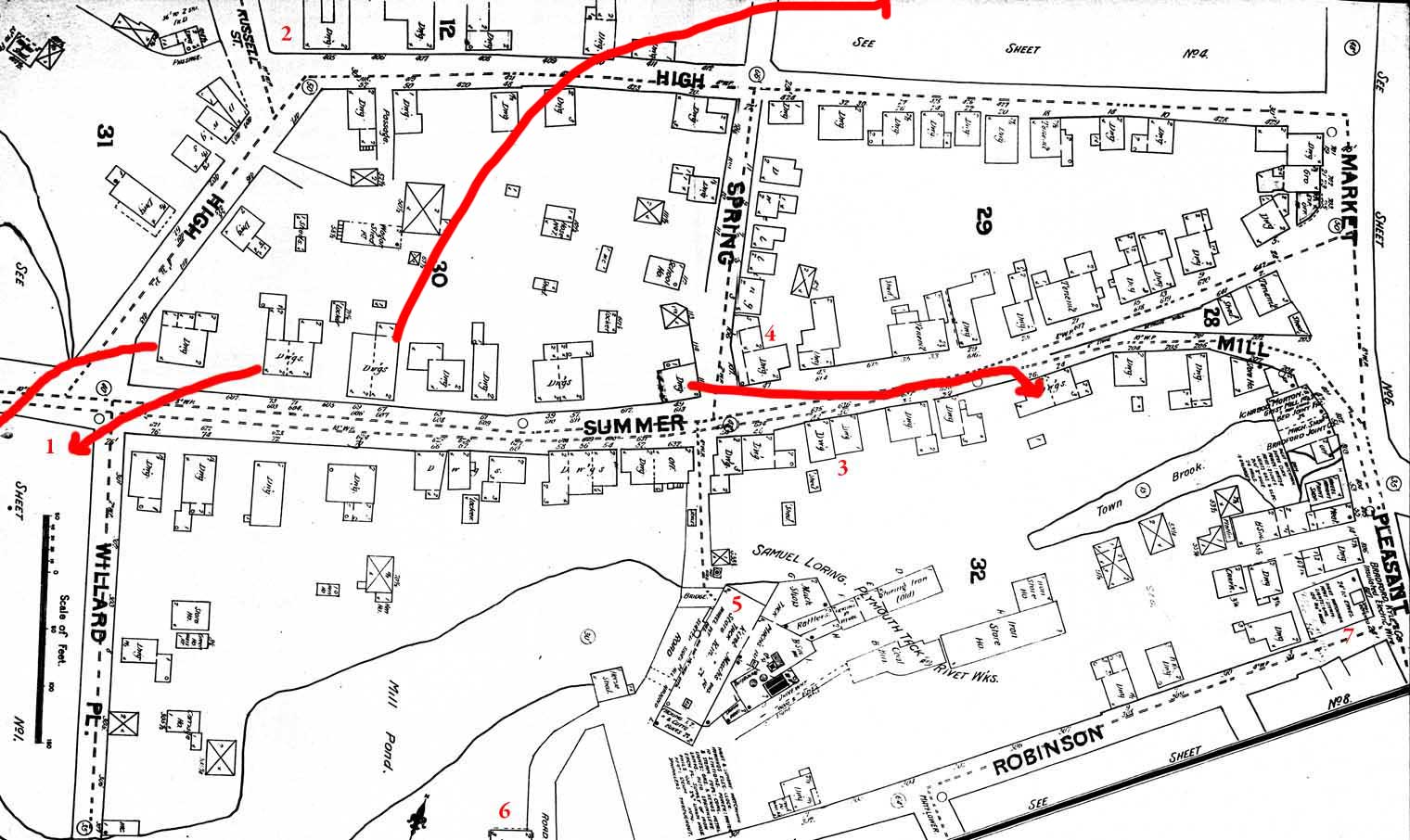
![]() The location of certain features are hard to describe verbally. High Street, which paralled Summer Street before 1970, is shown here. Map by Sanborn Fire Maps., 1891. The red arrows show where 4 buildings were moved during the
Redevelopment in the 1960s. Key: 1=Clough's store. 2=the Rider Home, only surviving High St. house. 3=Sparrow House. 4=Leach House (1679, demolished during Redevelopment) 5=Loring Tack Factory, site of Jenney Grist Mill. 6. Entrance to Poor House. 7=Robinson Meeting House
The location of certain features are hard to describe verbally. High Street, which paralled Summer Street before 1970, is shown here. Map by Sanborn Fire Maps., 1891. The red arrows show where 4 buildings were moved during the
Redevelopment in the 1960s. Key: 1=Clough's store. 2=the Rider Home, only surviving High St. house. 3=Sparrow House. 4=Leach House (1679, demolished during Redevelopment) 5=Loring Tack Factory, site of Jenney Grist Mill. 6. Entrance to Poor House. 7=Robinson Meeting House
